
Products
| >> Manufacturer | >> Fusion Charts |

|
2454
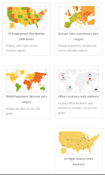
FusionMaps XT FusionMaps XT offers beautiful interactive maps to plot geographical data like revenue by regions, population by state, survey and election results effectively. You can also drop markers on the map to pinpoint places like office locations and flight routes.
Manufacturer:  Fusion Charts Reference URL: http://www.fusioncharts.com/explore/fusionmaps/
Note: Product information provided above is for reference only. For the detail of the product, please help to visit manufacturer's web site for more information.
|
Useful Links
- Android Development
- Apple IOS Development
- BlackBerry Developer
- Chupa Mobile
- Code Project
- Code.org
- Codecademy
- Coderbyte
- Codes School
- Coding4fun
- Corona SDK
- Data One
- Developer.com
- GearBox Software
- Hacker Rank
- Idynamic Media Company Limited
- Intel AppUp
- Marmalade
- Node.js
- Not Invented Here
- npmjs
- Photon Server
- Profi Developers
- Scratch
- Stackoverflow
- TED
- The Go Programming Language
- Unity 3 - game development tool
- Unreal Engine
- XCode - Apple Development
- Yo Yo Games